
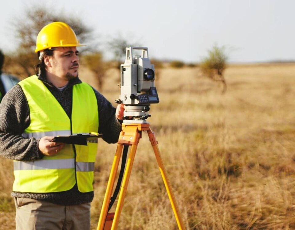
The Ultimate Guide to Property Surveys in Chesapeake, Virginia
May 22, 2026
Survey vs Plat vs Deed: What’s the Difference?
July 10, 2026For many homeowners in Portsmouth, Virginia, property ownership seems straightforward until a question about boundaries arises. Perhaps you are planning to install a new fence, build a shed, add a swimming pool, plant a row of trees, or simply want to understand exactly where your property begins and ends. At that point, one of the first questions you may ask is, “How do I find my property corners?”
Property corners are the legal reference points that define the boundaries of your land. They serve as the foundation for property lines and determine where your ownership rights begin and where your neighbor’s property starts. While many people assume their property corners are easy to locate, the reality is often much more complicated, especially in older Portsmouth neighborhoods where markers may have been disturbed, buried, removed, or hidden by decades of landscaping and development.
Understanding how property corners are established and how they can be located is essential for protecting your investment and avoiding costly disputes. Whether you own a historic home near Olde Towne Portsmouth, a waterfront property, or a newer residential lot, knowing the location of your property corners can provide valuable peace of mind.
What Exactly Are Property Corners?
Property corners are the physical points that define the limits of a parcel of land. When a property is originally surveyed, licensed land surveyors establish these points based on legal descriptions found in deeds, plats, and public records.
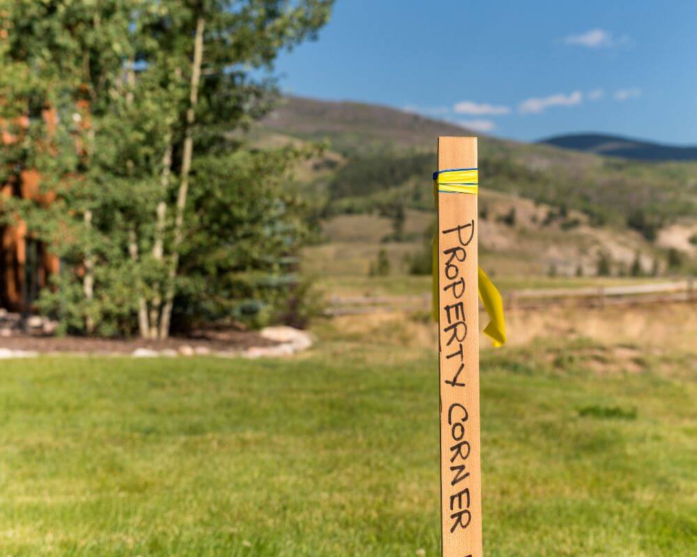
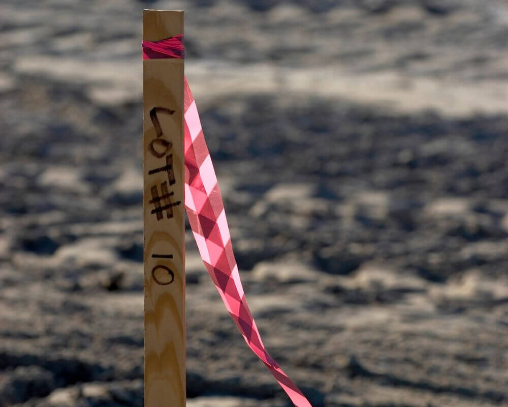
These corners are often marked using iron rods, iron pipes, rebar, concrete monuments, brass caps, or other durable surveying markers. The specific type of marker depends on when the property was surveyed, local regulations, and the standards that were in place at the time.
The corners serve as the starting and ending points for the property boundary lines shown on survey maps and legal documents. Every measurement that defines your lot is tied to these corner locations. If a corner marker is moved or disturbed, it can create confusion regarding the property’s true boundaries.
In Portsmouth, where some neighborhoods have existed for generations, original property markers may have been buried under soil, pavement, landscaping, or construction projects. This makes locating them more challenging than many homeowners expect.
Why Homeowners in Portsmouth Search for Property Corners
There are many reasons why property owners need to locate their corners. One of the most common situations involves fence installation. Before investing thousands of dollars in a new fence, homeowners want to ensure they are building on their own property and not encroaching onto a neighboring lot.
Home improvement projects are another major reason. Sheds, detached garages, pools, patios, additions, and retaining walls often have setback requirements that depend on accurate property boundary locations. Without knowing where your property corners are, it becomes difficult to verify compliance with local regulations.
Property sales and purchases also create a need for corner identification. Buyers often want reassurance that the boundaries represented in a listing accurately reflect the property being purchased. Sellers may need updated information before listing their homes.
Disputes between neighbors frequently begin because one party assumes a certain area belongs to them without confirming the actual boundary. In many cases, a simple property survey can resolve misunderstandings before they become legal conflicts.
Start With Your Property Survey
The first step in finding your property corners is reviewing any existing survey documentation you may already have.
Many homeowners receive a survey when they purchase a property. This survey may be included with closing documents, title paperwork, or mortgage records. If you do not have a copy, your title company, lender, attorney, or local records office may have one available.
A survey provides valuable information about your lot dimensions, corner locations, easements, structures, and property boundaries. Most surveys include measurements from fixed reference points that can help identify where corner markers are located.
Carefully reviewing the survey allows you to understand the shape of your property and the approximate location of each corner before beginning a physical search.
In Portsmouth, many residential lots are rectangular, but some properties have irregular shapes due to historical subdivisions, road alignments, waterfront features, or redevelopment projects. A survey helps eliminate guesswork and provides a reliable starting point.
Understanding Common Survey Markers
Many property owners are surprised when they discover that property corner markers are often small and difficult to identify.
An iron rod placed flush with the ground may only be visible after removing grass, leaves, or soil. Some markers are buried several inches below the surface due to years of landscaping, erosion, or lawn maintenance.
Surveyors frequently use iron rebar with plastic caps identifying the surveying firm responsible for the work. Older properties may contain iron pipes, concrete monuments, or metal disks installed decades ago.
Because these markers are designed for accuracy rather than visibility, they are not intended to be obvious landscape features. A property corner marker may be hidden beneath a layer of sod or located within dense vegetation.
When searching for corners, homeowners often use a metal detector to help identify buried iron markers. However, locating metal alone does not guarantee you have found the correct corner marker. Many yards contain buried utilities, construction debris, old fencing materials, and other metal objects that can create false indications.
Using Measurements From Your Survey
After reviewing your survey, you may be able to use the measurements provided to estimate where your corners are located.
Most surveys reference fixed features such as the corners of your home, sidewalks, utility poles, road edges, or other permanent structures. Using a measuring tape, you can measure distances shown on the survey and compare them to existing site conditions.
For example, if a survey indicates a property corner is located a specific distance from the corner of your house, you may be able to narrow down the search area significantly.
While this approach can sometimes help identify visible markers, it is important to understand its limitations. Small measurement errors can create significant inaccuracies over longer distances. Additionally, structures shown on older surveys may have changed over time.
For this reason, measurements should be viewed as an approximation rather than a legal determination of property boundaries.
Challenges Unique to Portsmouth Properties
Finding property corners in Portsmouth presents several unique challenges. The city contains a diverse mix of historic neighborhoods, waterfront parcels, urban lots, and modern residential developments.
Older neighborhoods often contain property records that date back many decades. Over time, original survey markers may have been damaged, removed, or obscured by landscaping and construction. Changes in roads, sidewalks, and surrounding development can also make historical boundary evidence more difficult to interpret.
Properties located near waterways may experience shifting conditions caused by erosion, shoreline improvements, or environmental factors. In some cases, these conditions require specialized surveying expertise to accurately determine boundaries.
Additionally, many Portsmouth properties contain mature trees, fencing, sheds, driveways, and other improvements that can complicate the process of locating original corner monuments.
These factors make professional surveying services especially valuable when precise boundary information is required.
Can You Find Property Corners Yourself?
Many homeowners wonder whether they can locate their property corners without hiring a surveyor. The answer depends on the level of certainty required and the condition of the existing markers.
If original monuments are still in place and your survey provides sufficient information, you may be able to identify corner markers yourself. Homeowners often have success locating visible rebar, iron pipes, or survey caps that match the approximate locations shown on a survey.
However, it is important to understand that simply finding a metal object in the ground does not guarantee that it represents a legal property corner. Boundary determination is a professional process that involves evaluating deeds, plats, adjoining property records, historical surveys, physical evidence, and measurement data.
In Virginia, only a licensed land surveyor can legally establish or reestablish property boundaries. While homeowners can search for existing markers, they should avoid making assumptions that could lead to costly mistakes.
This distinction becomes especially important when major projects are involved. Installing a fence, constructing a building addition, or resolving a boundary dispute based solely on an estimated corner location can create significant legal and financial consequences.
Signs Your Property Corners May Be Missing
In many situations, property corners are no longer visible or may have been destroyed altogether. There are several indicators that suggest professional assistance may be needed.
One common sign is when no corner markers can be located despite a thorough search using survey measurements and metal detection equipment. If the survey references monuments that no longer appear to exist, the corners may need to be reestablished.
Another indicator is conflicting evidence. Perhaps a fence line suggests one boundary location while a deed description suggests another. In these situations, determining the correct boundary requires professional analysis.
Properties that have experienced substantial grading, construction, utility work, landscaping, or road improvements are also more likely to have disturbed corner markers.
Older Portsmouth properties often present these challenges because decades of development can alter the original landscape significantly.
Why GPS Apps Are Not Enough
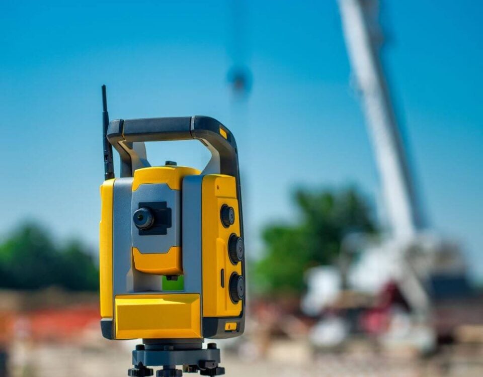
Modern technology has created the impression that GPS can solve every location problem. While GPS is an excellent navigation tool, consumer-grade GPS devices and smartphone apps generally do not provide the accuracy required for legal boundary determination.
Most consumer GPS systems can vary by several feet depending on conditions. Property corners, however, often require accuracy measured in fractions of an inch.
A few feet of error may not matter when finding a restaurant or navigating a city street, but it can be significant when determining whether a fence is on the correct side of a property line.
Professional surveyors use advanced equipment, including robotic total stations, survey-grade GPS systems, and sophisticated data processing methods to achieve highly accurate results. These tools are significantly more precise than consumer technology and are supported by professional standards and legal requirements.

The Risk of Guessing Property Boundaries
One of the biggest mistakes homeowners make is assuming they know where their property lines are based on existing fences, landscaping, or verbal information from neighbors.
Fences are not always installed on property lines. In some cases, fences may be intentionally set back several feet from a boundary. In other situations, they may have been installed incorrectly years ago and remain uncorrected.
Trees, shrubs, driveways, and other visible features can create similar misconceptions. Just because something has existed in a certain location for years does not necessarily mean it reflects the legal property boundary.
Relying on assumptions can lead to disputes that become expensive and time consuming. A fence built in the wrong location may need to be relocated. Structures placed across a property line can create legal complications that affect future property sales.
Accurate boundary information is always less expensive than correcting a mistake after construction is complete.
When You Should Hire a Professional Surveyor
There are several situations where hiring a licensed land surveyor is strongly recommended.
If you are planning to build a fence, pool, garage, shed, home addition, retaining wall, or any permanent improvement near a property line, a professional survey provides confidence that the project is positioned correctly.
Surveying services are also valuable when purchasing property. An updated boundary survey can reveal encroachments, easements, access issues, and other concerns that may affect ownership rights.
Neighbor disputes are another common reason to engage a surveyor. Rather than relying on assumptions or informal measurements, a professional survey establishes an objective basis for understanding property boundaries.
Property owners who simply want certainty regarding their land ownership often find that a survey provides peace of mind and protects the long-term value of their investment.
What Happens During a Property Corner Survey?
When a licensed surveyor is hired to locate property corners, the process begins with extensive research. The surveyor reviews deeds, plats, previous surveys, public records, and other documents related to the property and surrounding parcels.
Field work follows the research phase. Surveyors search for existing monuments, collect measurements, evaluate physical evidence, and compare their findings with historical records.
Using specialized equipment, the surveyor determines whether existing markers are valid and identifies the precise locations of property corners. If original monuments are missing, the surveyor may reestablish corner positions based on professional analysis and legal standards.
Once the work is complete, the surveyor can provide documentation showing boundary locations, corner positions, and other important property information.
This process ensures that property boundaries are determined accurately and defensibly.
Understanding Boundary Disputes in Portsmouth
Boundary disputes can arise even between otherwise friendly neighbors. Misunderstandings often develop when assumptions replace documented evidence.
A homeowner may believe a fence represents the true boundary because it has existed for decades. Another may rely on information passed down from previous owners. In some cases, landscaping or maintenance patterns create perceptions of ownership that differ from legal property records.
Professional surveys provide clarity by establishing boundary locations based on documented evidence rather than assumptions. This objective information often helps resolve disagreements before they escalate into legal conflicts.
Because Portsmouth contains many established neighborhoods with long histories of ownership and development, boundary questions are not uncommon. Obtaining accurate survey information is often the most effective way to protect relationships while safeguarding property rights.
Protecting Your Property Investment
Your home is likely one of the largest investments you will ever make. Understanding exactly what land you own is an important part of protecting that investment.
Property corners form the foundation of every boundary line associated with your parcel. Whether you are planning improvements, buying or selling property, addressing a neighbor concern, or simply seeking peace of mind, accurate corner locations are essential.
While homeowners can sometimes locate existing markers on their own, professional surveying remains the most reliable method for confirming property boundaries. Licensed surveyors bring the expertise, equipment, and legal knowledge necessary to establish accurate corner positions and provide dependable documentation.
For Portsmouth homeowners, investing in accurate boundary information today can prevent costly disputes, construction delays, and legal complications tomorrow.
Finding your property corners in Portsmouth, VA is not always as simple as looking for a metal rod in the ground. Property corners are legal boundary monuments that may be hidden, disturbed, or missing altogether. While surveys, measurements, and careful searching can help identify existing markers, only a licensed land surveyor can officially determine and verify property boundaries.
Whether you are installing a fence, planning a construction project, purchasing property, or resolving a boundary concern, understanding where your property begins and ends is critical. Professional surveying services provide the accuracy and confidence needed to make informed decisions and protect your investment for years to come.
When certainty matters, a professional property survey is the most effective way to locate your property corners and ensure that your Portsmouth property boundaries are accurately defined.
