Find a Surveyor the Right Way: What Homeowners Need to Know
February 17, 2026
How Modern Technology Is Changing Land Surveying in Virginia
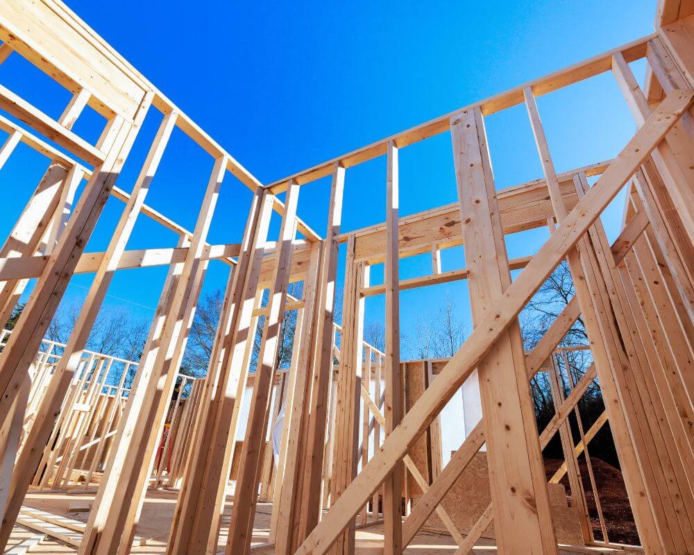
March 27, 2026Before construction begins on any building project, one of the most important steps is conducting a professional land survey. Builders rely on accurate surveying data to ensure that a project starts on the correct foundation—both literally and legally. A land survey provides essential information about property boundaries, topography, existing structures, and potential obstacles that may affect construction.
Without accurate survey data, builders risk making costly mistakes that can delay projects, increase expenses, or even lead to legal disputes. For this reason, professional land surveys are considered a critical step in the early stages of construction planning. Surveyors provide builders with precise measurements and detailed maps that guide every stage of the building process.
In Virginia, land surveys play an especially important role because of the state’s diverse landscapes and varying property regulations. From suburban neighborhoods and rural farmland to mountainous terrain and coastal regions, each construction site presents unique challenges that require careful evaluation.
Builders, architects, engineers, and developers all rely on survey data to make informed decisions about where and how structures should be built. A well-executed survey helps ensure that buildings are placed correctly within property boundaries, comply with zoning regulations, and align with the natural features of the land.
Understanding why builders require land surveys before construction helps property owners appreciate the value of this process and the role professional surveyors play in successful development projects.
The Role of Land Surveys in Construction Planning
Land surveys provide the foundational data needed to begin construction safely and accurately. Surveyors measure and document the physical characteristics of a property, allowing builders to understand the exact conditions of a site before construction begins.
A construction project involves many different professionals working together, including architects, engineers, contractors, and project managers. Each of these professionals relies on survey data to perform their work effectively.
For example, architects need survey information to design structures that fit within property boundaries and comply with zoning regulations. Engineers use topographic data to evaluate elevation changes, drainage patterns, and soil conditions. Contractors rely on survey markers and layout data to position foundations, walls, and utilities correctly.
Without accurate survey data, these professionals would have to rely on assumptions rather than verified measurements. Even small errors in measurement can lead to significant problems later in the construction process.
Land surveys eliminate this uncertainty by providing precise measurements and verified property information. This allows builders to begin construction with confidence, knowing that the project is aligned with legal boundaries and site conditions.
Defining Property Boundaries
One of the most important reasons builders require land surveys is to determine the exact boundaries of a property. Boundary surveys establish the legal limits of a parcel of land and identify where construction is permitted.
Property boundary lines are not always obvious when looking at a piece of land. Fences, landscaping features, or previous construction may not accurately reflect legal property boundaries. Over time, markers may disappear or records may become unclear.
Professional surveyors analyze property deeds, historical records, and existing markers to determine the precise boundaries of a property. They then place survey markers that indicate these boundaries clearly on the ground.
Builders rely on this information to ensure that new structures are built entirely within the property limits. Constructing a building that crosses into a neighboring property can create serious legal issues and may require expensive modifications or removal of structures.
Boundary surveys also help ensure compliance with setback requirements, which are local regulations that specify how far buildings must be placed from property lines. These rules are designed to maintain adequate spacing between structures and preserve access for utilities and emergency services.
By clearly defining property boundaries before construction begins, surveyors help builders avoid disputes and ensure that projects meet local regulations.
Site Planning and Design
Survey data is also essential for effective site planning and building design. Every piece of land has unique characteristics that influence how structures should be built.
Topographic surveys measure elevation changes across a property, identifying slopes, hills, valleys, and drainage patterns. This information allows architects and engineers to design structures that align with the natural features of the land.
For example, a property with steep slopes may require special foundation designs or retaining walls to ensure stability. Drainage patterns must also be considered to prevent water from collecting near buildings or causing erosion.
Survey data helps engineers determine how stormwater should flow across a property and where drainage systems should be installed. Proper drainage design is essential for protecting both the building and surrounding land.
In addition to elevation data, surveys identify existing features such as trees, utility lines, roadways, fences, and nearby structures. Builders must account for these elements when planning construction to avoid conflicts or damage to existing infrastructure.
Site planning surveys provide a comprehensive overview of the property, allowing designers to create plans that maximize functionality while minimizing environmental impact.
Ensuring Compliance With Local Regulations
Construction projects must comply with numerous local regulations and zoning requirements. These rules vary depending on the location of the property and the type of development being planned.
Many municipalities in Virginia require a professional land survey before issuing building permits. The survey verifies that the proposed construction meets zoning requirements and does not violate property boundaries or setback regulations.
Local governments use survey data to evaluate whether a project meets planning standards related to property use, building height, lot coverage, and environmental protections.
For example, some properties may fall within flood zones or environmental protection areas. Survey data helps determine whether additional precautions or permits are required before construction can begin.
Builders rely on survey reports to submit accurate documentation during the permitting process. Without a survey, obtaining approval for construction projects may be delayed or denied.
By ensuring compliance with local regulations, land surveys help streamline the permitting process and reduce the risk of costly delays.
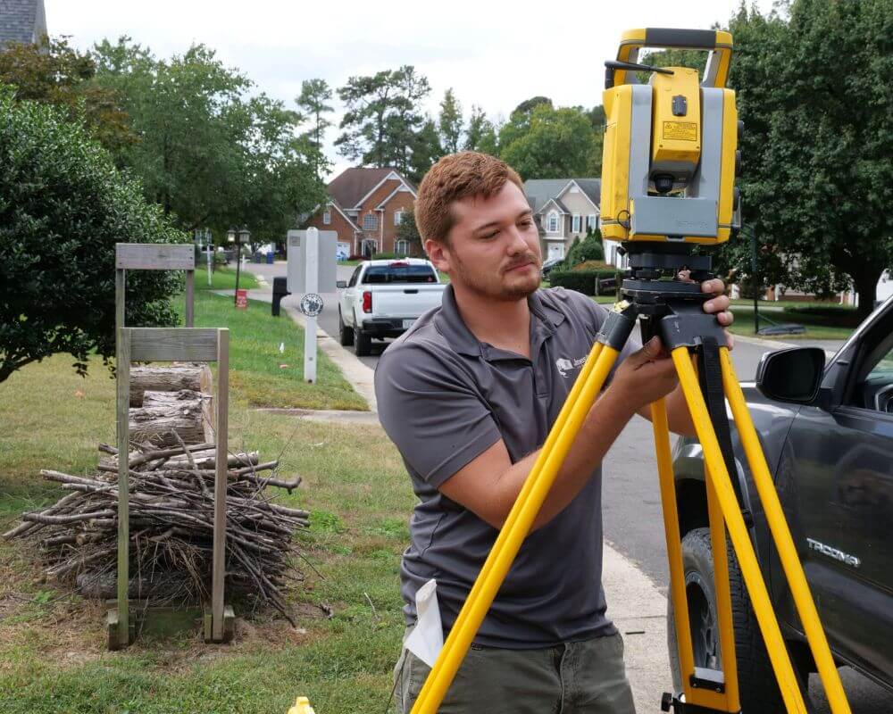
Construction Staking and Layout Surveys
Once planning and design are complete, land surveyors continue to play a critical role during the construction phase. One of the most important services provided at this stage is construction staking, also known as construction layout.
Construction staking involves placing markers on the property to show builders exactly where structures should be built. These markers guide contractors during excavation, foundation placement, and structural framing. Surveyors translate architectural and engineering plans into precise physical reference points on the site.
For example, surveyors may mark the exact location of:
- Building corners
- Foundation lines
- Utility connections
- Driveways and roadways
- Property setbacks
- Elevation benchmarks
These markers ensure that construction crews build structures in the correct locations and at the correct elevations. Without these reference points, contractors would have to estimate placement based on drawings alone, which could lead to costly errors.
Construction staking is especially important for larger projects such as residential subdivisions, commercial buildings, and infrastructure developments. In these situations, multiple structures must be placed accurately across large areas of land.
Surveyors may return to a site several times during construction to verify measurements and ensure that work remains aligned with approved plans. This ongoing involvement helps prevent mistakes and ensures that the project stays on schedule.
Topographic Surveys for Builders
Another essential survey type used before construction is the topographic survey. Topographic surveys measure the elevation and contours of a property, allowing builders to understand the shape and features of the land.
Unlike boundary surveys, which focus on property lines, topographic surveys provide a detailed map of natural and man-made features on a site. These features may include:
- Hills and slopes
- Drainage patterns
- Trees and vegetation
- Utility poles and underground utilities
- Existing buildings and structures
- Roadways and access points
This information is extremely valuable for architects and engineers who must design structures that fit the terrain.
For example, if a property has significant elevation changes, engineers may need to design special foundations, retaining walls, or grading plans to ensure structural stability. Understanding the slope of the land also helps prevent drainage issues that could lead to flooding or erosion.
Topographic surveys also help determine how water flows across a property during heavy rainfall. Proper drainage design is essential to protect buildings and prevent damage to surrounding land.
By providing a detailed picture of the land’s physical characteristics, topographic surveys help builders make informed decisions about how to design and position structures on a property.
Avoiding Costly Construction Errors
One of the most important reasons builders require land surveys before construction is to prevent expensive mistakes. Construction projects involve significant financial investments, and even small measurement errors can lead to serious consequences.
For example, if a building is constructed too close to a property line, it may violate local setback regulations. In some cases, this could require modifications to the structure or even partial demolition.
Similarly, incorrect elevation measurements could result in drainage problems that cause water damage or flooding. Fixing these issues after construction is complete can be extremely costly.
Surveying helps prevent these problems by providing accurate data before construction begins. Surveyors verify property boundaries, confirm elevation levels, and ensure that building plans align with the physical characteristics of the site.
Builders who invest in professional surveying services early in the planning process are far less likely to encounter unexpected problems later in the project.
This proactive approach saves time, reduces risk, and helps ensure that construction proceeds smoothly.

Utility and Infrastructure Planning
Land surveys also play an important role in planning utility connections and infrastructure systems. Modern buildings require access to a variety of utilities, including water lines, sewer systems, electricity, gas lines, and telecommunications infrastructure.
Surveyors help identify the location of existing utilities on a property so that construction plans can avoid damaging these systems. Accidentally striking underground utilities during excavation can create safety hazards and cause costly project delays.
Survey data also helps engineers determine where new utility lines should be installed. Proper placement of utility infrastructure ensures that buildings receive reliable services while minimizing disruption to surrounding areas.
For larger developments such as residential communities or commercial complexes, surveyors may assist with planning road networks, drainage systems, and public infrastructure improvements.
Accurate surveying data helps ensure that these systems function effectively and comply with local planning regulations.
Protecting Property Owners and Builders Legally
In addition to guiding construction, land surveys provide important legal protections for both property owners and builders. Survey reports serve as official documentation that verifies property boundaries and construction placement.
This documentation can be essential if disputes arise between neighboring property owners. For example, if a neighbor claims that a structure crosses a property line, the survey provides clear evidence of the true boundary location.
Survey documentation may also be required during property sales or refinancing transactions. Lenders and title companies often request surveys to verify that structures are located correctly within property boundaries.
Builders benefit from these protections as well. By relying on professional survey data, contractors can demonstrate that construction followed approved plans and complied with regulations.
These legal safeguards help reduce risk and provide peace of mind for everyone involved in a construction project.
When Property Owners Should Order a Land Survey
While builders almost always require land surveys before beginning construction, property owners may also need surveys in several situations. Understanding when to order a professional land survey can help prevent legal issues and ensure that projects proceed smoothly.
One of the most common times property owners request a survey is when purchasing land or a home. A boundary survey confirms the exact limits of the property and identifies any potential encroachments, such as fences or structures that may extend across property lines.
Property owners may also request surveys when planning improvements such as building additions, fences, garages, or driveways. These projects often require permits from local authorities, and survey documentation helps demonstrate that the improvements comply with zoning and setback requirements.
Surveys are also important when subdividing land or developing multiple lots. Developers rely on surveyors to divide properties accurately and create legal descriptions for each parcel.
Even homeowners who are not planning construction may benefit from obtaining a survey if property boundaries are unclear or if disputes arise with neighbors. Having an official survey provides reliable documentation that can resolve disagreements and protect property rights.
By understanding when surveys are necessary, property owners can take proactive steps to ensure that their projects and property investments are protected.
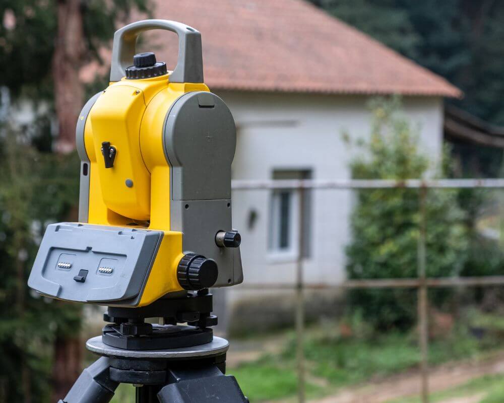
The Importance of Professional Land Surveyors
Although modern surveying technology has significantly improved measurement capabilities, the expertise of professional land surveyors remains essential. Surveying is not simply about operating equipment—it requires specialized knowledge, training, and experience.
Professional surveyors must interpret property records, analyze historical boundary information, and apply legal principles when determining property lines. These responsibilities require a deep understanding of land laws, measurement standards, and mapping techniques.
In Virginia, licensed land surveyors must meet strict education, training, and licensing requirements. These professionals are responsible for ensuring that surveys are accurate and compliant with state regulations.
Surveyors also play an important role in resolving complex boundary issues. In many cases, property records may contain conflicting information or missing markers. A skilled surveyor can analyze these records and determine the correct boundary locations.
Because construction projects rely heavily on accurate measurements, hiring a qualified surveyor is one of the most important steps builders and property owners can take before beginning development.
The Future of Surveying in Construction
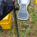
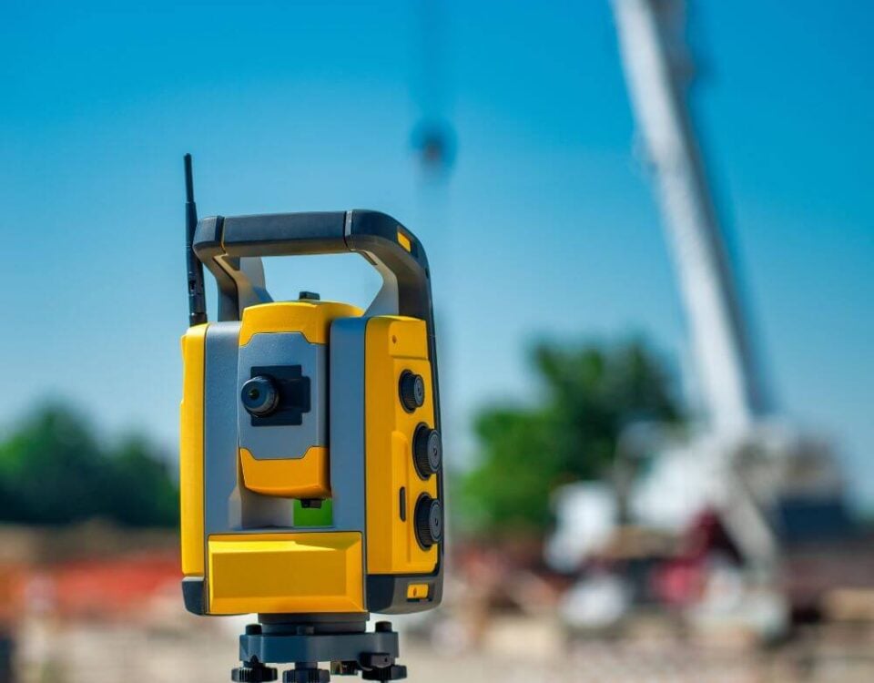
The surveying industry continues to evolve as new technologies emerge. Tools such as drones, LiDAR scanning, GNSS positioning systems, and advanced mapping software have dramatically improved the speed and accuracy of surveying work.
In the future, these technologies will likely become even more integrated into construction planning and project management. Automated data processing, artificial intelligence, and cloud-based collaboration tools will allow surveyors to provide more detailed information to clients in less time.
For example, drone mapping technology can already capture detailed aerial imagery of construction sites, allowing engineers and developers to monitor progress throughout the building process. LiDAR scanners can create highly accurate 3D models of terrain and structures, helping designers plan projects more effectively.
These technological advancements do not replace the role of professional surveyors but instead enhance their ability to deliver accurate and comprehensive data.
As construction projects become more complex and development continues across Virginia, the demand for reliable surveying services will continue to grow.
Land surveys are an essential step in the construction process. Before builders begin excavation, foundation work, or structural framing, they must have a clear understanding of the property boundaries, terrain, and site conditions. Professional land surveys provide the accurate data needed to plan and execute construction projects successfully.
Surveyors help builders avoid costly mistakes by verifying property lines, measuring elevation changes, identifying existing infrastructure, and ensuring compliance with local regulations. These services protect property owners, contractors, and developers from legal disputes, construction errors, and project delays.
Modern surveying technology has significantly improved the efficiency and accuracy of these services. Tools such as GNSS satellite positioning, drones, LiDAR scanning, and digital mapping software allow surveyors to collect detailed geographic data faster than ever before.
Despite these technological advancements, the expertise of professional surveyors remains critical. Their training, experience, and understanding of property law ensure that survey data is interpreted correctly and applied effectively during construction planning.
For builders and property owners in Virginia, investing in a professional land survey before construction begins is one of the most important steps in ensuring a successful project. Accurate surveying provides the foundation for safe, compliant, and efficient development.
By working with experienced land surveyors, builders can move forward with confidence, knowing that their projects are built on reliable data and sound planning.

