
What Does a Virginia Land Surveyor Actually Do? A Virginia Homeowner’s Guide
January 6, 2026
Installing a Fence? Why a Fence Property Survey Is Critical Before You Build
February 4, 2026Commercial development is a complex process with countless moving parts, site selection, zoning, financing, design, permitting, construction, and long-term asset management. At every stage, accuracy matters. Decisions made early can either set a project up for success or create delays, disputes, and unexpected costs that ripple through the entire development timeline.
One discipline quietly underpins nearly every successful commercial project: land surveying.
Too often, surveying is viewed as a preliminary step, something required to “get started.” In reality, professional land surveying is a strategic tool that influences feasibility, design efficiency, regulatory compliance, risk mitigation, and long-term property value. When done correctly, it creates clarity. When overlooked or delayed, it becomes a source of costly setbacks.
This article explores the critical role land surveying plays in successful commercial development, why experienced surveyors are essential partners, not vendors, and how developers who prioritize surveying gain a competitive advantage.
Why Land Surveying Is Foundational to Commercial Development
Commercial development begins with land, but land is rarely as straightforward as it appears. Property boundaries, zoning restrictions, easements, environmental features, and infrastructure all intersect before a single shovel hits the ground.
Land surveying provides the verified, legally defensible data that allows developers to move forward with confidence.
At its core, land surveying answers fundamental questions:
- What exactly do we own?
- Where can we build?
- What limitations exist?
- How does the site interact with surrounding properties and infrastructure?
Without clear answers to these questions, commercial projects operate on assumptions, and assumptions are expensive.
Site Selection and Feasibility Analysis
Before acquisition or entitlement, developers must evaluate whether a site is viable for its intended use. Surveying plays a critical role in early feasibility analysis.
Establishing Legal Boundaries
A professional boundary survey confirms the true extent of the property and identifies:
- Legal parcel limits
- Adjacent ownership
- Encroachments
- Boundary conflicts
For commercial sites, especially those assembled from multiple parcels, even minor discrepancies can derail transactions or delay closings.
Identifying Easements and Rights-of-Way
Easements often dictate what can, and cannot, be built. Utility easements, access rights, drainage corridors, and shared-use agreements may severely limit usable space.
Early identification allows developers to:
- Adjust site layout
- Avoid design rework
- Negotiate solutions before purchase
- Prevent post-acquisition surprises
Surveyors map these constraints clearly so stakeholders can make informed decisions upfront.
Understanding Physical Site Constraints
Topography, floodplains, wetlands, and existing infrastructure all affect development costs and timelines. Survey data reveals:
- Elevation changes
- Drainage patterns
- Slopes and grading challenges
- Existing utilities and structures
These details inform budgeting, engineering design, and risk assessment long before construction begins.

Zoning, Entitlements, and Regulatory Compliance
Commercial development operates within a regulatory framework that varies by jurisdiction. Surveying provides the documentation required to navigate approvals efficiently.
Supporting Zoning and Land Use Applications
Accurate survey plats are often required for:
- Rezoning requests
- Site plan approvals
- Conditional use permits
- Subdivision approvals
Surveyors ensure property data aligns with zoning ordinances, setbacks, height restrictions, and land use classifications, reducing friction during review processes.
Avoiding Compliance Issues Before They Start
Setback violations, lot coverage miscalculations, and boundary errors can result in:
- Permit denials
- Redesigns
- Stop-work orders
- Legal exposure
Surveying identifies potential conflicts early, allowing teams to adjust plans before regulatory scrutiny intensifies.
Design Coordination and Engineering Accuracy
Modern commercial development relies on tight coordination between architects, engineers, planners, and contractors. Survey data serves as the common reference point that keeps everyone aligned.
Creating a Reliable Design Foundation
Surveyors provide the base layer for:
- Civil engineering plans
- Utility layouts
- Structural design
- Drainage and grading plans
Accurate data reduces conflicts between disciplines and minimizes costly revisions during later phases.
Preventing Design-Field Conflicts
When survey data is incomplete or outdated, discrepancies often surface during construction. These issues lead to:
- Change orders
- Schedule delays
- Increased costs
- Contractor disputes
Up-to-date surveying ensures design intent matches field conditions.
Construction Phase: Risk Reduction and Cost Control
Once construction begins, the role of land surveying becomes even more critical.
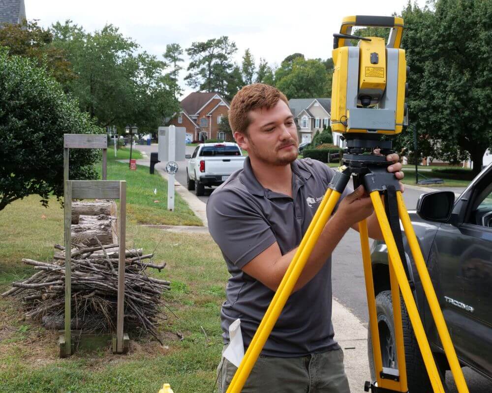
Construction Staking and Layout
Surveyors provide precise staking to guide:
- Building placement
- Road alignments
- Utility installation
- Foundation layout
Accurate layout prevents rework and ensures improvements are built in the correct location the first time.
Verifying Progress and Compliance
Surveying during construction confirms that:
- Structures align with approved plans
- Elevations meet specifications
- Setbacks and easements are respected
This verification protects developers, contractors, and lenders alike.
ALTA/NSPS Surveys and Commercial Transactions
For many commercial projects, particularly those involving financing or institutional investment, ALTA/NSPS Land Title Surveys are essential.
These surveys provide:
- Nationally recognized standards
- Comprehensive boundary and improvement data
- Easement documentation
- Title insurer-required certifications
ALTA surveys reduce transactional risk and support financing, refinancing, and asset transfers.
Long-Term Value and Asset Protection
Surveying doesn’t stop when construction ends. Accurate survey documentation supports long-term asset management by:
- Facilitating future expansions
- Simplifying property transfers
- Supporting lease agreements
- Reducing legal disputes
Well-documented properties are easier to manage, finance, and sell.
Surveying as a Strategic Investment, not an Expense
Successful commercial developers understand that land surveying is not a line item to minimize, it’s an investment in clarity, efficiency, and risk reduction.
The cost of professional surveying is small compared to the cost of:
- Construction delays
- Legal disputes
- Redesigns
- Title defects
When surveyors are engaged early and treated as strategic partners, projects move faster, smoother, and with fewer surprises.
Common Surveying Mistakes That Derail Commercial Projects
Even experienced development teams can run into trouble when surveying is misunderstood, rushed, or treated as a checkbox rather than a strategic phase. Many of the most expensive commercial development issues trace back to preventable surveying mistakes.
Delaying Surveying Until After Acquisition
One of the most common errors is postponing a full survey until after a property is purchased. Without complete survey data during due diligence, developers risk acquiring land with:
- Hidden easements
- Boundary conflicts
- Access limitations
- Environmental constraints
These issues can significantly impact feasibility and reduce usable acreage, often requiring costly redesigns or renegotiations.
Relying on Incomplete or Outdated Survey Data
Old plats or partial surveys may appear sufficient, but they rarely reflect current conditions. Changes in zoning, utilities, infrastructure, or neighboring developments can render older data inaccurate.
Incomplete data leads to:
- Design conflicts
- Permitting delays
- Construction errors
- Increased liability
Commercial development demands current, comprehensive surveying.
Failing to Coordinate Surveying with Design Teams
Surveying should not happen in isolation. When surveyors aren’t integrated with architects, engineers, and planners, discrepancies arise that surface late in the process.
Strong coordination ensures:
- Consistent data across disciplines
- Fewer plan revisions
- Faster approvals
- Smoother construction sequencing
How Late-Stage Surveying Delays Projects
Engaging surveyors late in the process often leads to cascading delays that impact timelines and budgets.
Redesigns Triggered by New Information
When surveys reveal previously unknown constraints, such as easements or setbacks, designs must be revised. These revisions ripple through:
- Engineering plans
- Permit submissions
- Contractor schedules
Late changes are far more costly than early adjustments.
Permitting and Approval Bottlenecks
Many jurisdictions require survey-backed documentation for approvals. Missing or inaccurate surveys can result in:
- Rejected applications
- Resubmittals
- Extended review cycles
These delays affect financing timelines and construction start dates.
Risk Management: Surveying as Legal Protection
Commercial development carries inherent legal risk. Professional surveying significantly reduces exposure by providing defensible documentation.
Preventing Boundary and Encroachment Claims
Encroachments, such as buildings crossing property lines or easements, can result in:
- Litigation
- Forced removal
- Financial penalties
Surveying identifies these risks before construction, not after.
Supporting Title Insurance and Financing
Lenders and title insurers rely on survey data to assess risk. Accurate surveys:
- Support underwriting
- Reduce title exceptions
- Streamline closings
ALTA/NSPS surveys, in particular, are essential for institutional transactions.

Case Examples: Surveying Done Right vs. Done Late
Case 1: Early Surveying Saves Time and Money
A mixed-use development engaged surveyors during site selection. Early surveys revealed a drainage easement that limited buildable area. The design team adjusted layout before acquisition, avoiding redesign costs and accelerating approvals.
Result: On-time delivery and preserved ROI.
Case 2: Late Surveying Creates Costly Delays
A retail development relied on an old plat during design. A post-permit survey revealed a utility easement beneath the planned foundation.
Result: Design revisions, permit delays, construction hold, and significant cost overruns.
Choosing the Right Surveyor for Commercial Development
Not all surveyors are equipped to handle the complexity of commercial projects. Developers should evaluate surveyors based on more than price.
Key Qualities to Look For
- Commercial project experience
- Knowledge of local regulations
- Ability to coordinate with multidisciplinary teams
- Clear communication and documentation
- Advanced technology and quality control processes
Surveyors who understand development workflows add value far beyond measurements.
Why Local Expertise Matters in Commercial Surveying
Commercial development is deeply influenced by local conditions. Surveyors with regional expertise understand:
- Jurisdictional approval processes
- Local land use history
- Infrastructure constraints
- Regional development patterns
This knowledge accelerates approvals and reduces risk.
Surveying Across the Development Lifecycle
Surveying supports commercial projects from inception to completion and beyond.
Pre-Development
- Boundary surveys
- Feasibility analysis
- Due diligence support
Design & Entitlement
- Topographic surveys
- ALTA surveys
- Site plan support
Construction
- Construction staking
- As-built surveys
- Progress verification
Post-Construction
- Final plats
- Record drawings
- Asset documentation
Surveying continuity ensures consistency and accountability at every stage.
Why Surveying Is a Competitive Advantage
Developers who prioritize surveying gain:
- Faster project timelines
- Fewer surprises
- Reduced legal risk
- Improved stakeholder confidence
In competitive markets, clarity and efficiency make the difference between stalled projects and successful developments.
A Developer’s Checklist for Surveying Success
Successful commercial projects don’t leave surveying to chance. The most efficient developers follow a consistent process to ensure surveying supports, not slows, the project.
Before moving forward, developers should confirm:
- ☐ A current boundary survey is completed during due diligence
- ☐ Easements, rights-of-way, and access points are fully identified
- ☐ Topographic data is accurate and design-ready
- ☐ Survey data is shared across all design and engineering teams
- ☐ ALTA/NSPS requirements are confirmed early (if applicable)
- ☐ Construction staking is scheduled before site mobilization
- ☐ As-built surveys are planned for closeout and record drawings
This proactive approach minimizes rework and ensures all stakeholders are aligned from start to finish.
Frequently Asked Questions About Commercial Land Surveying
When should a surveyor be involved in a commercial project?
As early as possible, ideally during site selection and due diligence. Early involvement prevents feasibility issues and design conflicts later.
Are surveys required for every commercial project?
Most jurisdictions and lenders require surveys, especially for new construction, redevelopment, or financing. Even when not strictly required, surveys are strongly recommended.
What’s the difference between a boundary survey and an ALTA survey?
A boundary survey establishes property limits, while an ALTA/NSPS survey meets national standards required by lenders and title companies, providing additional detail and certifications.
How often should a commercial property be resurveyed?
Any time ownership changes, financing is involved, expansions are planned, or significant time has passed since the last survey.
The Long-Term Impact of Accurate Surveying
Surveying doesn’t end when construction is complete. Accurate survey records continue to provide value throughout the life of a commercial asset by:
- Supporting future expansions or renovations
- Simplifying refinancing and resale
- Reducing title and boundary disputes
- Enhancing asset documentation and management
Properties with well-documented survey histories are easier to transact, manage, and develop over time.
Why Surveying Is a Strategic Advantage in Competitive Markets
In competitive commercial markets, speed and certainty matter. Developers who invest in professional surveying gain advantages others overlook.
Surveying enables:
- Faster approvals
- Cleaner financing
- Fewer design changes
- Reduced construction risk
- Stronger lender and investor confidence
When every delay impacts ROI, surveying becomes a tool for maintaining momentum, not just compliance.

Land Surveyors as Long-Term Development Partners
The most successful developers view surveyors not as vendors, but as strategic partners. Experienced commercial surveyors understand development pressures, regulatory landscapes, and construction realities.
They help teams:
- Anticipate challenges before they arise
- Navigate complex site conditions
- Maintain accuracy across project phases
- Protect investments from unnecessary risk
This partnership mindset leads to smoother projects and stronger outcomes.
Surveying Is the Backbone of Commercial Development
Every successful commercial development rests on a foundation of accurate information. Land surveying provides that foundation, defining boundaries, revealing constraints, guiding design, supporting construction, and protecting long-term value.
When surveying is prioritized early and integrated throughout the development lifecycle, projects move faster, costs stay controlled, and risks are reduced.
For developers, investors, and project managers, the question isn’t whether surveying is necessary, it’s how early and how well it’s done.


